

Downtown Arlington Heights is the vibrant, bustling center of our community, blending historic charm with modern, transit-oriented development. Here is a comprehensive guide to the location, boundaries, and key access points.
Downtown Arlington Heights is the vibrant, bustling center of our community, blending historic charm with modern, transit-oriented development. However, for new residents, visitors, or those just trying to get their bearings, pinpointing the exact footprint of our downtown area can be helpful.
Located approximately 25 miles northwest of downtown Chicago, Downtown Arlington Heights serves as the geographical, cultural, and civic hub of the Village of Arlington Heights. It is easily accessible by major highways, arterial roads, and commuter rail, making it one of the premier destinations in the northwest suburbs.
Here is a comprehensive guide to the location, boundaries, and key access points for Downtown Arlington Heights.
The Geographic Boundaries
While the Village of Arlington Heights covers over 16 square miles, the downtown district is a highly concentrated, walkable area. The core downtown area is generally defined by the following boundaries:
- West: South Chestnut Avenue
- East: South Arthur Avenue
- South: West Sigwalt Street (near the Village Hall)
- North: West Euclid Avenue
The absolute epicenter of the neighborhood is the intersection of West Campbell Street and North Vail Avenue. This pedestrian-friendly junction is surrounded by high-density residential buildings, local restaurants, boutique shopping, and the Metra train tracks.
Major Roads and Intersections
Downtown Arlington Heights is bisected by several major thoroughfares, making it highly accessible for drivers. The layout features a mix of traditional grid streets and diagonal avenues.
Key roads running through or adjacent to downtown include:
- Central Road: A major east-west connector located just south of the downtown district.
- Arlington Heights Road: Running north-to-south, this major thoroughfare connects downtown commuters directly to Interstate 90 (Jane Addams Memorial Tollway) to the south and Lake Cook Road to the north.
- US Route 14 (Northwest Highway): Running diagonally from the southeast to the northwest, this is the primary arterial road that borders the main Metra tracks.
For those driving to the area, downtown offers multiple parking garages, including the Vail Avenue Garage and the Municipal Garage, along with abundant street parking.
The Metra Station
One of the defining features of Downtown Arlington Heights is its integration with public transit. The neighborhood is built around the Arlington Heights Metra Station, which serves as a major anchor for daily commuters.
- Connections: The station is adjacent to Pace bus stops, providing connections to routes 606, 615, 616, and 696.
- Access: Located directly between Northwest Highway to the north and West Davis Street to the south.
- Transit Line: Union Pacific Northwest (UP-NW)
- Location: 45 West Northwest Highway, Arlington Heights, IL 60004
Because the station is situated right in the middle of the dining and shopping district, residents can easily walk from the train platform to their favorite downtown destinations within minutes.
Key Landmarks to Orient Yourself
If you are navigating the area on foot, several prominent landmarks help define the downtown footprint.
- The Metropolis Performing Arts Centre: Found at 111 W. Campbell Street, this theater is a central beacon for nightlife and culture.
- Village Hall: Located at 33 S. Arlington Heights Road, this municipal building anchors the southeastern edge of the downtown district.
- Arlington Heights Memorial Library: Situated just north of the downtown core at 500 N. Dunton Avenue, the library marks the northern transition into residential neighborhoods.
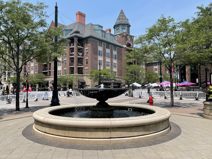
- Harmony Park: Located at the intersection of Vail Avenue and Campbell Street, this central green space is the site of summer concerts, the Sounds of Summer series, and the Arlington Heights Farmers Market.
Why the Location Matters
The location of Downtown Arlington Heights was intentionally developed to be a "transit-oriented" space. This means the neighborhood is designed to maximize access to public transport, thereby encouraging walkability and reducing reliance on cars.
With its grid-pattern streets and high concentration of amenities, the area boasts a high Walk Score. Residents can live, work, dine, and commute without ever leaving the central downtown footprint.
Whether you are arriving via the UP-NW Metra line, driving in from I-90, or walking from the surrounding residential neighborhoods, Downtown Arlington Heights is easy to find, easy to navigate, and located right at the heart of the community.
For interactive maps, parking guides, and real-time public transit schedules, visitors can access resources through the Village of Arlington Heights official website or the Metra UP-NW line schedule.